
Sólheimajökull Revisited
Since my original post three weeks ago, there have been multiple meetings with the companies operating in the area, the land owners, Ferðamálastófa, Veðurstófa Íslands, search & rescue and others, to discuss what can be done.
New Access
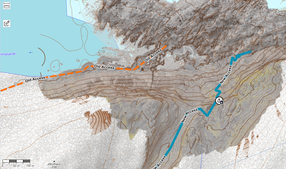
About a week ago the land owners agreed to allow access through the valley circling south and east around Jökulhaus, and the operators have now completed a track that allows groups to access the glacier by going down that slope towards the glacier.
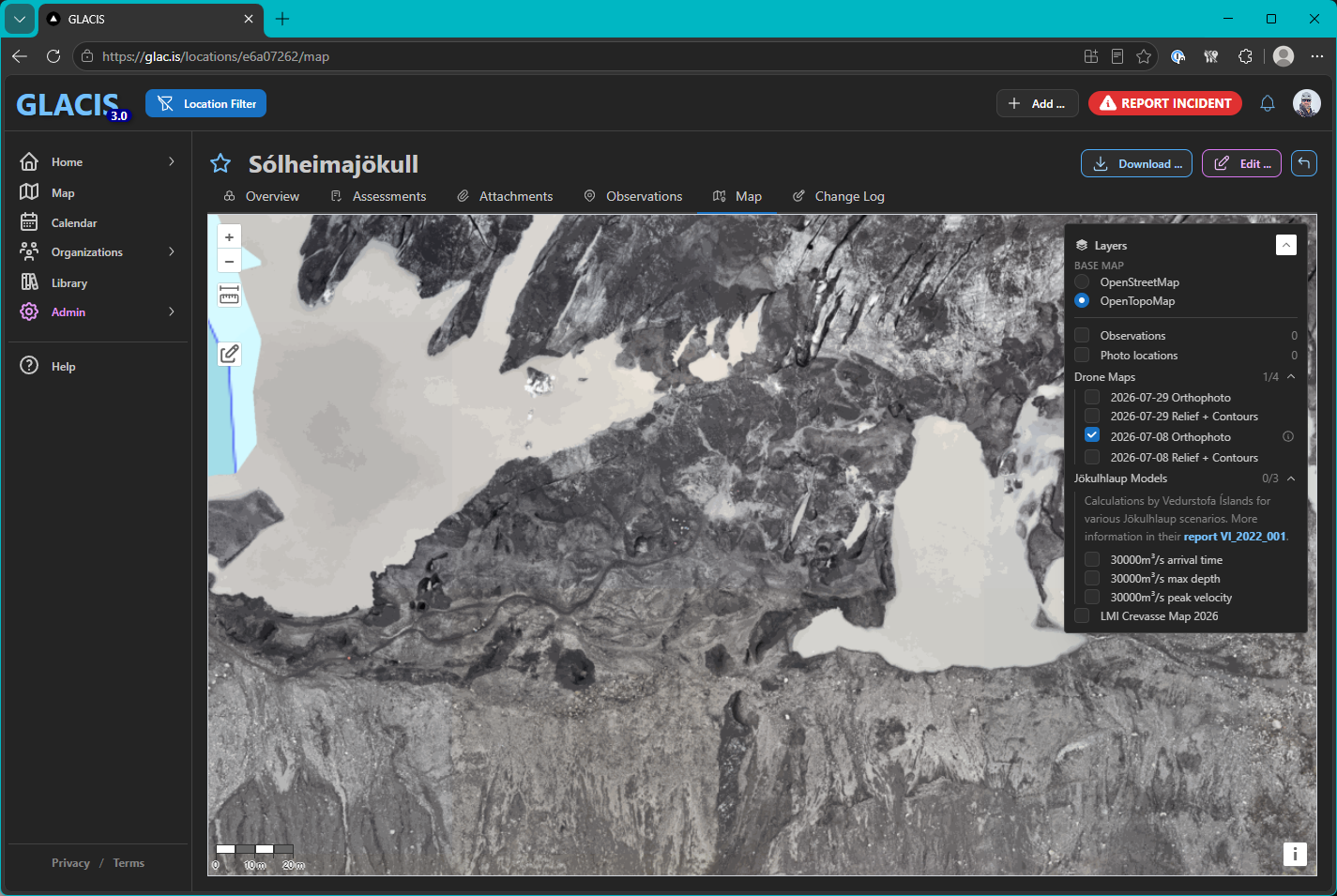
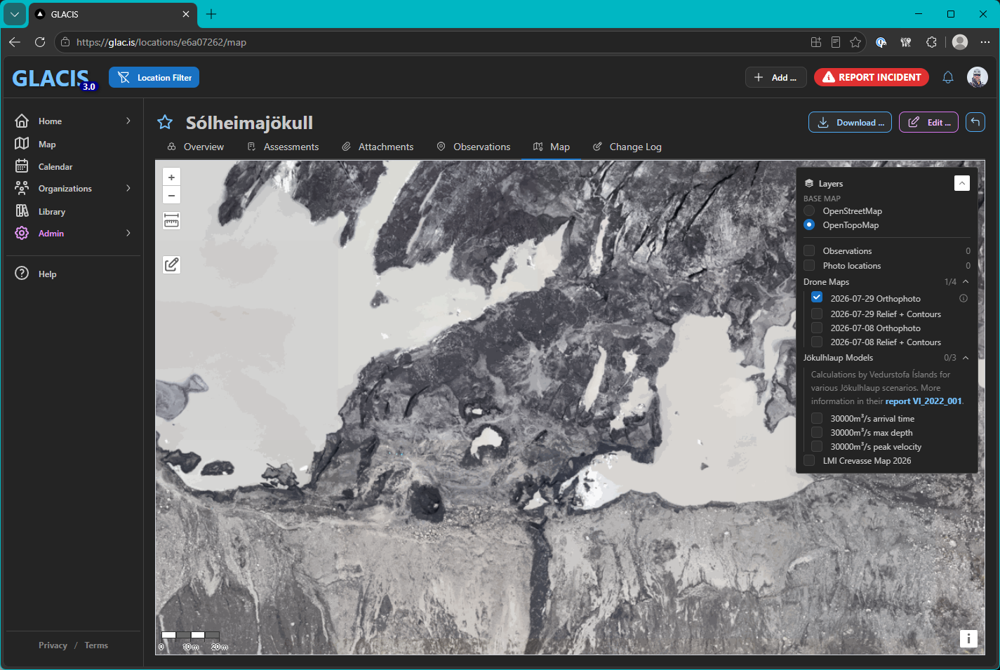
I had the opportunity to revisit Sólheimajökull yesterday and check out the new trail, and also create new maps for the GLACIS platform. From the map it is quite clear that this decision did not come a moment too soon – I was expecting to see some change, but the direct comparison makes it even more evident how much the glacier has changed and that the ice bridge has degraded significantly.
Interestingly, even though the two maps are not aligned perfectly (this would have required a more precise survey of ground control points than I was able to do), one can also observe how the glacier has been creeping forward.
The new access route leads through a very scenic valley landscape, and approaches the glacier over a saddle that gives a stunning view down over the glacier. Besides adding about an hour to the duration of the approach hike, the main difficulty is the descent (and, on the return trip, ascent) by the relatively steep slope from that sadle to the edge of the glacier. A short section near the top which is somewhat exposed to a steeper fall/tumble has been fixed with a hand line for people to hold onto, and the trail itself is well manicured.
However, if the previous tour was already a bit of a stretch in terms of fitness and ability for a customer, the new route may become a problem for them.
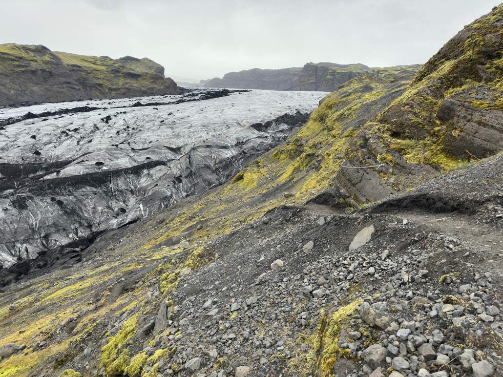
Looking forward, I think the new route is a great solution but might become challenging towards the winter, especially in repeating freeze-thaw conditions when one would expect large parts of the trail to become glazed / ice covered. Considering the frequency and scale of tours on Sólheimajökull I also wonder if the current path – which does not allow for much space to pass groups going in the other direction – will need to be reshaped further (both to allow groups going in both directions more easily, and in preparation for winter conditions). The extended duration and somewhat exposed approach also allows for much less tolerance for bad weather.
Emergency Scenarios
Perhaps my main concern for the current solution is that there is no easy escape route. The old access is essentially blocked by a deep ravine that formed in the dead ice / scree slope just east of the ice bridge (which I would expect to fully disintegrate within a very short timeline), which means that any land based rescue scenario will be forced to use the new route.
Fortunately the new route already has a few anchors near the top, which would make it relatively easy to build a belay for a stretcher carry in the steep terrain. From my conversation with guides I met in the area, there are plans to add additional anchors near the top and run through a full rescue scenario to determine the hardware, manpower, and time required. I think this is a great plan, and I hope it will be performed in collaboration between all the operators in the area.
In emergency situations there is an incredible amount of cooperation and mutual aid between guides from different companies. For this to work as efficiently as possible, everybody needs to have the same concept of how the rescue should be performed, and this is best established by training together. Those practice scenarios are also critical for understanding the scale of response needed to deal with even relatively minor mishaps.
Is land-based the only option?
In severe cases it is quite obvious that one would request an evacuation by helicopter, if available and possible, but given the somewhat limited resources it might be frivolous to call them in for extractions that are perhaps not as time critical – and there are also days where a helicopter may not be able to fly / land on the glacier, or they may be busy responding to other incidents.
So, while they should always be considered as an option, it would be dangerous to rely on them without having viable alternative plans.
One additional option that comes to mind is a water-based evacuation. Given that there are already kayak tours on the lake, if a suitable landing site can be reached via the glacier this may be a much more gentle and faster option than a stretcher carry up the mountain and through the valley (where at least part of the trail could be navigable by ATV). Of course a water-based stretcher rescue comes with considerable risks, especially if the patient is immobile, and must be prepared for, trained, and executed with great care.It also has its own limitations in terms of weather, but I believe it might be an option worth considering – especially if a zodiac boat is already available as a rescue craft for the kayak tours.
One can never have too many options for dealing with emergency scenarios, and a water based evacuation could also be a good emergency exit if the valley route somehow becomes impassable while groups are on the ice.
Unguided Visitors
One other issue that was quite obvious during our visit is that there are a rather great number of tourists still exploring the old route, and venturing out over the ice bridge. I know there were plans of preparing and installing new / additional signage, but am not sure if that has already happened and is just being ignored, or yet to come.
In any case, I believe that the risk for unguided visitors roaming around this area is substantially higher than for tours actually entering the glacier, in particular also because there are now only very few (if any) guides around who would have the skills and tools to respond if an incident occurred in the area.
I am quite certain that most people are blissfully unaware that they have been walking on dead / floating ice for a long time before even getting close to what they believe to be the edge of the glacier.
Fortunately this is probably a relatively limited time until the ice bridge has fully deteriorated – at which point the glacier is essentially inaccessible from this path which will hopefully discourage people from venturing out from there. But of course the rockfall hazard remains, and may indeed increase while the dead ice that is evidently underneath much of the slope continues to dwindle.
One must also expect that unguided visitors will also discover that the new route leads to a very scenic viewpoint, and will follow guided tours on the new path. I think suitable signage should also be installed at the lookout, to avoid people meeting with misadventure should they try to proceed down the steeper terrain in unsuitable footwear and bad weather.