New Map!
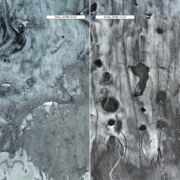
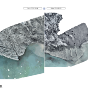
I am having some technical difficulties with my drone which in addition to the COVID situation has been delaying my mapping project in the past months. On the last flight, the camera white balance unexpectedly changed during a battery swap leading to blue tint for half of the map which I only detected after completion of the flight. I did not have sufficient spare batteries to repeat the flight, so I accepted that it is what it is.
But in more positive news, I created a new WordPress plugin that allows me to directly embed my maps (without the comparison feature, which is the main reason to head on over to the main project site).
 © 2019 stephan mantler / Háfjall ehf.